
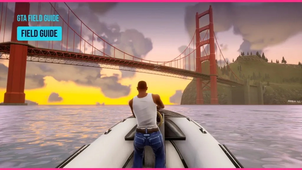
GTA San Andreas map: Los Santos, San Fierro and Las Venturas
By Gareth Linwood Fact-checked by Terrence Abiola Published
Guinness World Records’ entry from the game’s 2004 era gives Grand Theft Auto: San Andreas about 44 km² (17 sq mi) of playable land. The fictional state has three cities: Los Santos (Los Angeles), San Fierro (San Francisco) and Las Venturas (Las Vegas). Five rural counties fill the space between them. This guide covers every region, the real places behind them, why size estimates disagree, and how the 2004 map differs from the San Andreas in GTA V.
Key takeaways
- San Andreas has three cities and five counties: Red County, Flint County, Whetstone, Tierra Robada and Bone County.
- Size figures run from about 35 to 44 km² because sources measure land, water and borders in different ways.
- Large parts of the map copy real places: LAX, the Presidio, the Castro, Hoover Dam, Lake Mead and Area 51.
- GTA V’s San Andreas has only Los Santos and Blaine County. San Fierro and Las Venturas are not in it.
- The November 2024 Definitive Edition update added Classic Lighting, which brings back PS2-style fog, clouds and colors.
Fact-checked
We checked these key facts against the sources named, on November 12, 2026:
- At about 36 to 44 km², it was the biggest GTA map of its time (source: gta.fandom.com)
- Mount Chiliad rises here to about half a mile (800 m), the highest point in the state (source: gta.fandom.com)
- That made it the largest GTA map of its time (source: gta.fandom.com)
- Some measurements count the whole square and others count only land (source: gta.fandom.com)
- The Chiliad Challenge mountain-bike races run down its slopes. :::tip Agent’s note For the best view of the whole state, go to the top of Mount Chiliad (source: rockstargames.com)
San Andreas map at a glance
The 2004 map is a fictional US state built from parts of California and Nevada. Los Santos sits in the southeast, San Fierro in the west and Las Venturas in the northeast. Countryside, mountains and desert fill the space between them. Rockstar North developed the game and Rockstar Games published it under Take-Two Interactive.
Quick answers: size, cities, real-world inspiration
| Area | Type | Real-world inspiration | Key landmarks |
|---|---|---|---|
| Los Santos | City | Los Angeles County (LA, Long Beach, Inglewood, Beverly Hills, Compton, Santa Monica) | Grove Street, Vinewood, LSIA, Ocean Docks, Santa Maria Beach |
| San Fierro | City | San Francisco | Gant Bridge, Paradiso, Queens, Santa Flora |
| Las Venturas | City | Las Vegas | The Strip, Four Dragons Casino, Caligula’s Palace |
| Red County | County | California farm country | Palomino Creek, Montgomery, Dillimore, Blueberry |
| Flint County | County | Forested California hills | Flint Intersection, Leafy Hollow, Beacon Hill |
| Whetstone | County | Coastal mountains | Mount Chiliad, Angel Pine, Shady Creeks |
| Tierra Robada | County | Desert and bay towns of the Southwest | Bayside, El Quebrados, Las Barrancas |
| Bone County | County | Nevada desert | Area 69, The Big Ear, Verdant Meadows, Fort Carson |
A 2009 Guinness Gamer’s Edition entry summed up the state as three cities, 12 towns and “miles of countryside”. It also called the map up to four times larger than earlier GTA games.
Looking for GTA V or the real fault?
Two other things share the San Andreas name. GTA V’s San Andreas is a different, smaller version of the state; its section is further down. The real San Andreas Fault in California has its own section near the end, built on USGS data.
How big is the San Andreas map?
It is roughly 36 to 44 km² (about 14 to 17 sq mi), depending on who measured it. That made it the largest GTA map of its time. Grand Theft Auto V passed it in 2013.
Official vs community measurements
| Figure | km² | sq mi | Source | Notes |
|---|---|---|---|---|
| Guinness record | about 44 | about 17 | Guinness World Records, “largest playable area in a Grand Theft Auto videogame” | Record from the San Andreas era; probably includes more water and edge area |
| Community measurement | 36 | 13.9 | StrategyWiki and fan wikis | Land across the map’s islands, measured from game coordinates |
| 2013 press comparison | about 35 | 13.6 | Map comparisons published before GTA V launched | Put next to GTA IV (6.8 sq mi) and GTA V (49 sq mi) |
Why do the figures disagree? There are three main reasons:
- Water. The game world is a square that includes a lot of ocean. Some measurements count the whole square and others count only land.
- Borders. San Andreas is several islands linked by bridges. Where you draw the edge of each island changes the total.
- Units. Square miles and square kilometers get mixed up when figures are copied. One wrong conversion produces a “new” estimate.
Guinness World Records now lists Grand Theft Auto V, not San Andreas, for the largest playable area in a Grand Theft Auto game. Before GTA V came out, Rockstar told Game Informer its world was bigger than San Andreas, GTA IV and Red Dead Redemption combined. The 2013 comparisons above back that up.
Why San Andreas feels bigger than its square mileage
Players often ask why San Andreas feels bigger than GTA 5 when it is smaller. The layout explains it. Three separate cities make each trip feel like a journey to another place. Long empty roads through Flint County and the Bone County desert add travel time. And because the story keeps whole regions closed at first, you spend hours in Los Santos before the rest of the state opens.
Rockstar described its own approach in 2012. It said the San Andreas cities had been “very small, sketchlike” versions of the real ones. GTA V traded that variety for one detailed city.
The three cities
Each city has its own gangs, story chapter and real-world model. San Fierro is the smallest of the three.
Los Santos (Los Angeles)
Los Santos copies Los Angeles County, with pieces of Long Beach, Inglewood, Beverly Hills, Compton and Santa Monica. The story starts here, in Carl “CJ” Johnson’s old neighborhood on Grove Street in Ganton. The site’s guide to Grove Street and the Grove Street Families covers that area and its gang in detail.
- Districts: Ganton, Idlewood, East Los Santos, Vinewood (Hollywood), Rodeo (Beverly Hills), Santa Maria Beach (Santa Monica).
- Gangs: Grove Street Families, Ballas, Los Santos Vagos, Varrios Los Aztecas.
- Unlocks: Open from the start.
- Landmarks: Los Santos International (LSIA), Ocean Docks, the Vinewood sign.
San Fierro (San Francisco)
San Fierro is a smaller copy of San Francisco, with hills, cable-car-style streets and the Gant Bridge as its Golden Gate. CJ rebuilds his business here after the Los Santos chapter.
- Districts: Paradiso (the Presidio), Queens (the Castro), Santa Flora (Twin Peaks), Downtown, Doherty, Chinatown.
- Gangs: Triads, Da Nang Boys, San Fierro Rifa, plus the Loco Syndicate drug ring.
- Unlocks: After the Los Santos chapter ends.
Las Venturas (Las Vegas)
Las Venturas is the casino city in the northeast desert, built around a copy of the Las Vegas Strip. The Julius Thru-Way, which circles it, copies Interstate 215.
- Landmarks: The Strip, the Four Dragons Casino, Caligula’s Palace.
- Factions: The Leone, Sindacco and Forelli Mafia families, and the Triads through Woozie’s casino.
- Unlocks: Last, along with the desert counties.
Did you know?
Grand Theft Wiki notes that a scaled-down Groom Lake sits just south of Area 69. That copies the layout of the real Area 51 in Nevada.
The countryside: five counties
Five counties link the cities: Red County, Flint County and Whetstone in the green south and west, and Tierra Robada and Bone County in the northern desert.
Red County
Red County is farm country northeast of Los Santos. It has four small towns: Palomino Creek, Montgomery, Dillimore and Blueberry. CJ goes there early in the countryside chapter, and its towns are the setting for the Catalina missions.
Flint County
Flint County covers forest and hills west of Los Santos. Flint Intersection, Leafy Hollow, Beacon Hill and Back o’ Beyond are here. Its highways are the main road from Los Santos to San Fierro.
Whetstone and Mount Chiliad
Whetstone fills the southwest corner. Mount Chiliad rises here to about half a mile (800 m), the highest point in the state. The town of Angel Pine sits at its foot, and CJ is sent there when he is exiled from Los Santos. The Chiliad Challenge mountain-bike races run down its slopes.
Agent's note
For the best view of the whole state, go to the top of Mount Chiliad. You can also fly a plane out of Verdant Meadows once you own it. Either way you can see the three cities from one spot.
Tierra Robada
Tierra Robada is the northwest desert county just across the Gant Bridge from San Fierro. Its towns are Bayside, El Quebrados, Las Barrancas and Aldea Malvada.
Bone County, Area 69 and Sherman Dam
Bone County is the large desert west of Las Venturas. Grand Theft Wiki lists Fort Carson, Las Brujas, The Big Ear, El Castillo del Diablo, Green Palms, Hunter Quarry, Lil’ Probe’Inn, Octane Springs, Regular Tom, Sherman Reservoir and Verdant Meadows.
- Area 69: A secret government base based on Area 51. CJ breaks in during the mission Black Project.
- Verdant Meadows: An abandoned airfield CJ buys. Its flight school runs the Learning to Fly missions.
- The Big Ear: A large satellite dish complex, popular with UFO-myth hunters.
- Sherman Dam: Modeled on Hoover Dam, with Sherman Reservoir standing in for Lake Mead. Grand Theft Wiki notes that sources disagree on whether the dam sits in Bone County or Tierra Robada. Treat any map that states the border with confidence as one interpretation.
Real-life locations behind the map
Most big landmarks in San Andreas copy a real place. Many of those real places are open to visitors. If you are in LA and want to see spots from GTA San Andreas, use the table below as a starting point. The game is a loose copy, though, and you will not find exact matches.
| Landmark | Region | Real counterpart | Why it matters |
|---|---|---|---|
| LSIA | Los Santos | Los Angeles International (LAX) | Airport and flight travel hub |
| Ocean Docks | Los Santos | Port of Los Angeles | Industrial docks used in several missions |
| Vinewood | Los Santos | Hollywood | Mansions, the hillside sign |
| Paradiso | San Fierro | The Presidio | Northern district near the Gant Bridge |
| Queens | San Fierro | The Castro | Central neighborhood |
| Santa Flora | San Fierro | Twin Peaks | Hilltop district |
| Gant Bridge | San Fierro / Tierra Robada | Golden Gate Bridge | Main crossing to the north desert |
| Julius Thru-Way | Las Venturas | Interstate 215 | Ring road around the city |
| Sherman Reservoir | Bone County / Tierra Robada | Lake Mead | Water held back by Sherman Dam |
| Sherman Dam | Bone County / Tierra Robada | Hoover Dam | You can go inside the dam |
| Area 69 | Bone County | Area 51 | Black Project mission, jetpack |
Did you know?
According to Grand Theft Wiki, Sherman Dam has a walkable interior. You can go inside the game’s version of Hoover Dam, not just look at it from the road.
How the map unlocks
The map opens in three stages. Los Santos comes first. The countryside and San Fierro open after The Green Sabre. The desert and Las Venturas open after Yay Ka-Boom-Boom, a mission for Woozie.
Quick steps: unlock the full map
- Play the Los Santos story missions until The Green Sabre, the last one in that chapter.
- After The Green Sabre, the countryside counties and San Fierro open.
- Work through the San Fierro story arcs, including Woozie’s missions.
- Finish Yay Ka-Boom-Boom to open Tierra Robada, Bone County and Las Venturas.
If you wonder why you got four stars just for driving over the bridge to San Fierro, this is why. Crossing into a locked region gives you a four-star wanted level straight away. Police and helicopters keep chasing you until you leave or get busted.
Heads up
Locked regions trigger four stars the moment you enter. If you are carrying important weapons or a long mission streak, it is easier to finish the story steps than to try entering early.
Collectibles and map layers
San Andreas splits its main collectibles by region: 100 tags in Los Santos, 50 snapshots in San Fierro, 50 horseshoes in Las Venturas and 50 oysters underwater around the state. Those 250 items count toward 100% completion. The 70 unique stunt jumps do not.
| Collectible | Total | Where | Reward |
|---|---|---|---|
| Gang tags | 100 | Los Santos only | Weapons appear at the Johnson house |
| Snapshots | 50 | San Fierro only | $100 each, $100,000 for the set |
| Horseshoes | 50 | Las Venturas only | $100 each, $100,000 for the set, better gambling luck |
| Oysters | 50 | Underwater, statewide | $100 each, $100,000 for the set, maximum lung capacity |
| Unique stunt jumps | 70 | Statewide | Cash bonus for each one you land |
Agent's note
For a 100% run, use two maps: a plain labeled map to find your way around and an interactive map with collectible layers. Turn on one collectible type at a time.
Definitive Edition and mobile: what changed on the map
The Definitive Edition is a remaster of the 2004 game, with graphical enhancements and modern controls. What has changed is how the map looks. GTA: The Trilogy, The Definitive Edition, developed by Grove Street Games, updated the visuals. Later patches brought back much of the original atmosphere.
- December 14, 2023: The Trilogy, including San Andreas, launched on Netflix Games for mobile.
- April 9, 2024: A mobile-only update fixed, among other things, a collision bug with the spinning Sprunk can in San Andreas.
- November 12, 2024: A title update for PC, PS5 and Xbox Series X|S (PS4, Xbox One and Switch followed on November 13) added a Classic Lighting option, on by default. It also brought back clouds and fog. The San Andreas patch is v1.007. Neowin reported that the same update removed Grove Street Games’ name and logos from the splash screen and menus.
Does the Netflix version use the same map as the PC version? Yes. Both are the same remastered game. The two versions have had different patches at different times, and the mobile lighting arrived on other platforms with the November 2024 update.
Agent's note
If the Definitive Edition looks washed out to you, check that Classic Lighting is on in the graphics settings. It brings back the warmer PS2-era sunsets and the hazy desert.
San Andreas in GTA V vs GTA: San Andreas
GTA V’s San Andreas covers only Los Santos and Blaine County. San Fierro and Las Venturas are not on its map. The two games are set in different continuities: San Andreas belongs to Rockstar’s 3D universe (the PS2-era games), and GTA V belongs to the HD universe that started with GTA IV.
| Feature | GTA: San Andreas (2004) | GTA V (2013) |
|---|---|---|
| Continuity | 3D universe | HD universe |
| Cities | Los Santos, San Fierro, Las Venturas | Los Santos only |
| Countryside | Five counties | Blaine County |
| Highest peak | Mount Chiliad, about 800 m | Mount Chiliad (rebuilt) |
| Size | About 36 to 44 km² | Bigger than San Andreas, GTA IV and Red Dead Redemption combined, per Rockstar |
| Lead characters | CJ | Franklin, Trevor and Michael De Santa |
Some names carry over: Los Santos, Vinewood, Grove Street and Mount Chiliad all appear in GTA V, rebuilt from scratch. If you are looking for the San Andreas map in GTA 5, it is the game’s own pause-menu map. That map ends at Paleto Bay in the north.
Why aren’t San Fierro and Las Venturas in GTA 5? Rockstar chose to build one city in much more detail rather than three small ones. Fans who want the old three-city state online usually play Multi Theft Auto, which runs on the original San Andreas map.
From San Andreas to Leonida
San Andreas was the series’ first multi-city state. It sits in a line of GTA maps that runs from Liberty City to Leonida.
| Game | Year | Setting |
|---|---|---|
| GTA III | 2001 | Liberty City |
| GTA: Vice City | 2002 | Vice City |
| GTA: San Andreas | 2004 | State of San Andreas, 3 cities |
| GTA IV | 2008 | Liberty City (HD) |
| GTA V | 2013 | Los Santos and Blaine County |
| GTA VI | 2026 | State of Leonida, including Vice City |
CONFIRMED: Take-Two confirmed GTA VI’s November 19, 2026 release date again in its November 2026 earnings report, the last before launch. Leonida is the series’ second whole-state map after San Andreas. For timing on critics’ verdicts, see the site’s coverage of the GTA 6 review embargo.
Not the game? The real San Andreas Fault map
The real San Andreas Fault is a boundary between tectonic plates in California, not a place in a game. The USGS describes the fault system as more than 800 miles long and at least 10 miles deep.
- Length: More than 800 miles, according to the USGS.
- Depth: At least 10 miles.
- 1906 earthquake: The rupture that hit San Francisco ran 296 miles (477 km), per the USGS.
The fault runs from the Salton Sea area in Southern California to Cape Mendocino in the north. The USGS publishes fault maps, and Thule Scientific hosts an interactive map of the fault.
FAQ
Does San Andreas have a big map?
Yes. At about 36 to 44 km², it was the biggest GTA map of its time.
Which city is San Andreas in real life?
San Andreas is a state, not a city. Los Santos is based on Los Angeles, San Fierro on San Francisco and Las Venturas on Las Vegas.
How many cities does San Andreas have?
Three main cities, plus about a dozen countryside towns, such as Angel Pine, Palomino Creek and Fort Carson.
Where can I find the map of San Andreas in GTA 5?
Open the pause menu in GTA V. Its San Andreas is only Los Santos and Blaine County.
Is the GTA San Andreas map bigger than GTA 5?
No. Rockstar said GTA V’s world was bigger than San Andreas, GTA IV and Red Dead Redemption combined.
What are the counties in GTA San Andreas?
Red County, Flint County, Whetstone, Tierra Robada and Bone County.
What is Las Venturas based on?
Las Vegas. The Strip, the casinos and the Julius Thru-Way (based on I-215) all copy real Las Vegas features.
How do you unlock the whole map in GTA San Andreas?
Play the story. The Green Sabre opens the countryside and San Fierro. Yay Ka-Boom-Boom opens the desert and Las Venturas. Cheat codes change your stats, weapons and vehicles, but the site’s GTA San Andreas cheat list has no code that opens regions.
Is the Definitive Edition map different from the original?
It is a remaster, so the lighting, textures and weather effects are different. Since November 2024, Classic Lighting brings back much of the original look.
Where is the San Andreas Fault on a real map?
It runs through California, from the Salton Sea area to Cape Mendocino. The system is more than 800 miles long, according to the USGS.
Where’s the best place to see the whole map?
The top of Mount Chiliad, or a plane over the middle of the state. From up there, the way the three cities connect makes more sense than it does on any flat map.
Byline and sources
- Fact-checked by Terrence Abiola against the sources listed below before publication.
- Published
Checking and sources
- Researched from 8 sources, listed below.
- Every claim is checked by Terrence Abiola; anything we cannot confirm is corrected, labelled or removed.
Sources (8)
- Largest playable area in a Grand Theft Auto videogame - Guinness World Records (guinnessworldrecords.com)
- Guinness List of Resident Evil and Grand Theft Auto Records - Kotaku (kotaku.com)
- Grand Theft Auto: San Andreas/San Andreas - StrategyWiki (strategywiki.org)
- San Andreas in GTA San Andreas - Grand Theft Wiki (grandtheftwiki.com)
- San Andreas (3D Universe) - GTA Wiki (gta.fandom.com)
- Sherman Dam - Grand Theft Wiki (grandtheftwiki.com)
- Bone County - Grand Theft Wiki (grandtheftwiki.com)
- Area 69 - Grand Theft Wiki (grandtheftwiki.com)
